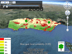
Visualising Climate Futures
Outputs from the Victorian Climate Change Adaptation Program (VCCAP) include a number of maps a based on (i) land suitability, (ii) adaptive capacity and (iii) climate change data for all of Victoria. These map are available through the Victoria Resources Online Geographical Visualisation Portal and can be interactively viewed through the Google Earth API.
